Dateline June 13, 2011, Across Prince William Sound and Down the Kenai
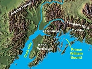
We had written about the wildlife and glaciers we saw on the trip to the Columbia Glacier, and the ferry across to Whittier was a continuation of that experience. It was hard not to keep saying wow out loud. That word captured the beauty and majesty of the place better than anything else we could think of. Prince William Sound was first charted by Captain Cook in 1778, who originally named it Sandwich Sound after the Earl of Sandwich. It was later renamed for Prince William Henry, who eventually became King William IV. The sound is now part of the Chugach National Forest, 5.4 million acres, roughly the size of New Hampshire, with 3,500 miles of intricate coastline, hundreds of tidewater glaciers, and bountiful wildlife. The Good Friday earthquake of 1964 reshaped the place. The crew on the ferry pointed out one peak that had been split clean through, and we could see daylight between the two halves. As we pulled into Whittier we learned the town had been built as a secret port during World War II, an alternative to Seward in case of a Japanese attack. From the ferry we drove through a single lane tunnel shared by cars and trains, alternating direction, 2.5 miles long,
the longest of its kind in North America. On the far side we caught our first sight of Portage Glacier above Portage Lake.
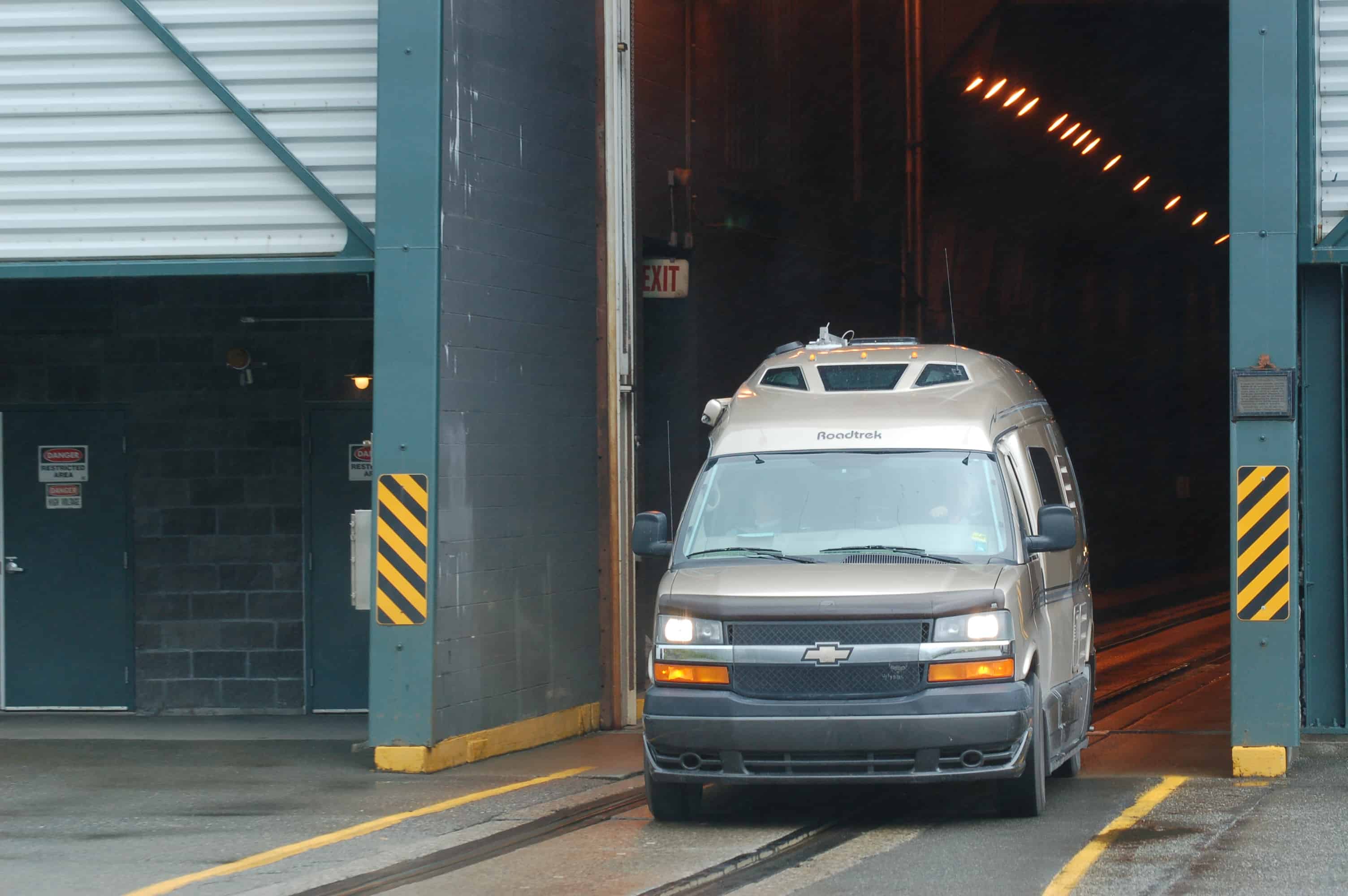
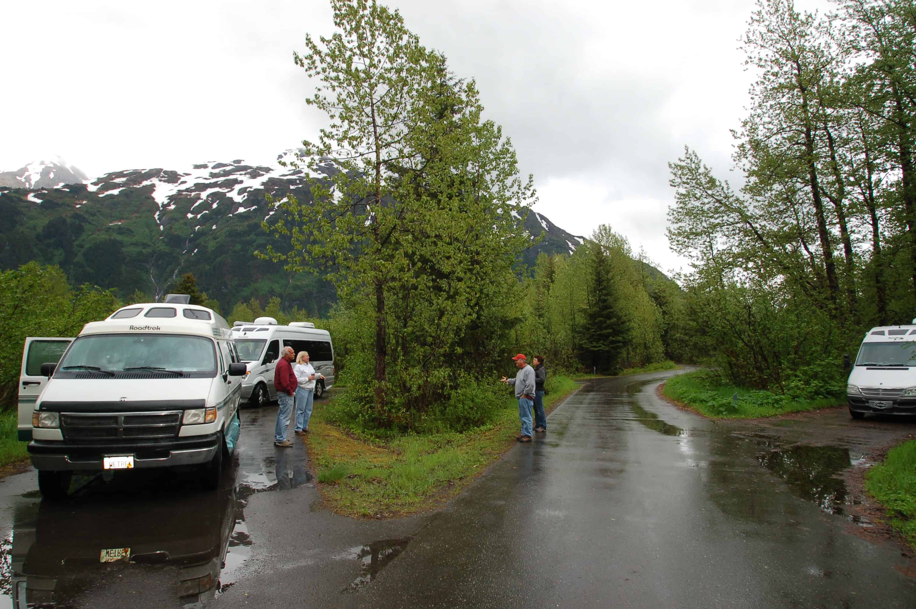
This was our entry into the Kenai Peninsula, often called Alaska's premier recreational playground. We spent the night at the Williwaw campground with four other Roadtreks.
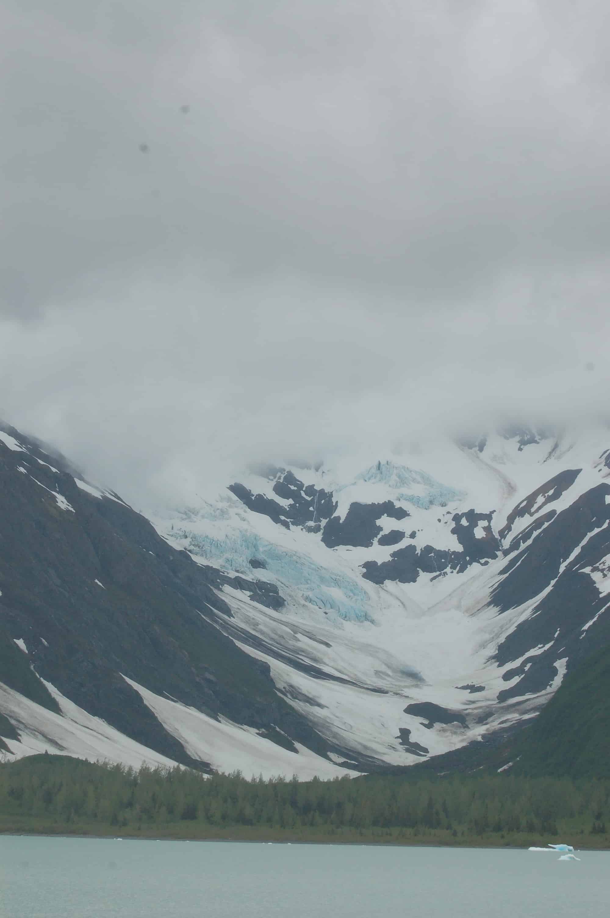
In the morning we visited or viewed the six glaciers of the Portage Valley: Portage, Shakespeare, Burns, Byron, Middle, and Explorer.

Driving up toward Highway One, which runs north to Anchorage, we were struck by how much the earthquake had changed the area. Stands of dead trees still marked the spots where seawater had flowed into the valley.
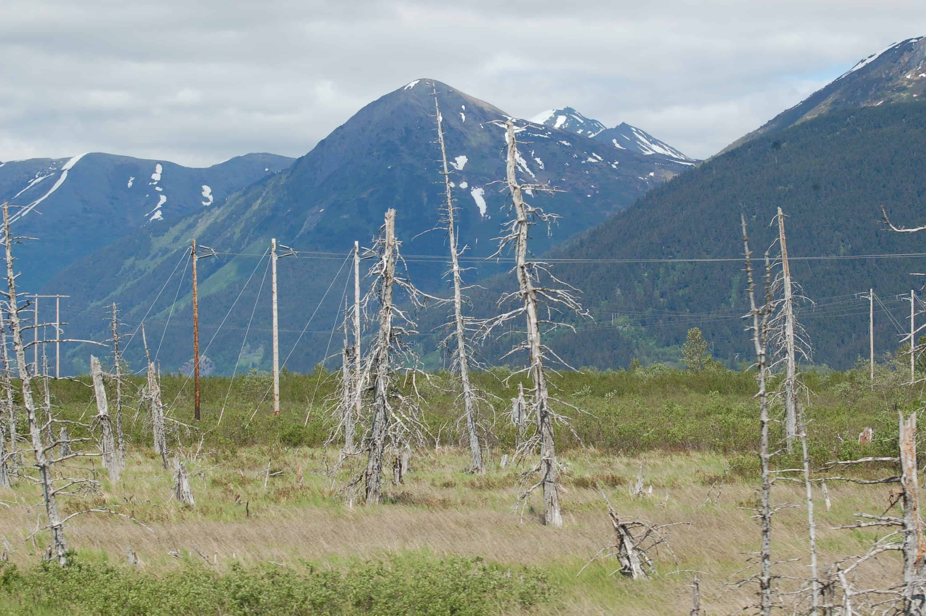
The valley took 100 foot waterspouts of mud and water as the land slumped eight feet, and the incoming tides poured in, burying buildings under silt and forcing the town to be abandoned. Forty-seven years later, the valley has gone marsh-like and is supporting new growth again. Our next stop was the Alaska Wildlife Conservation Center, where various animals were being nursed back to health for release into the National Forest. The musk ox was a highlight.
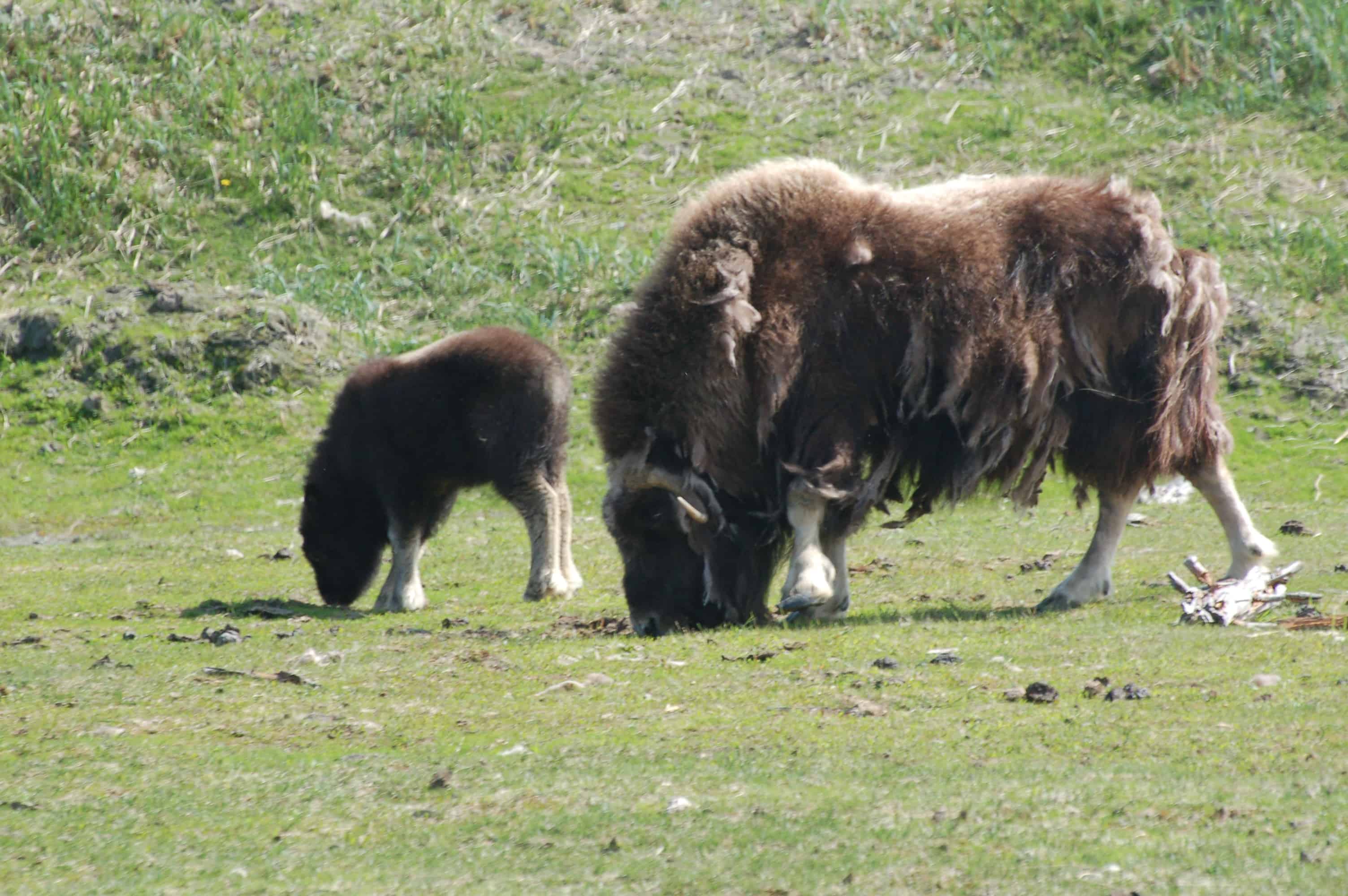
Known to native Alaskans as "Oomingmak," meaning "The Bearded One," this once-endangered animal produces an annual harvest of qiviut, the finest wool in the world. We also met two Kodiak cubs who had lost their mother.
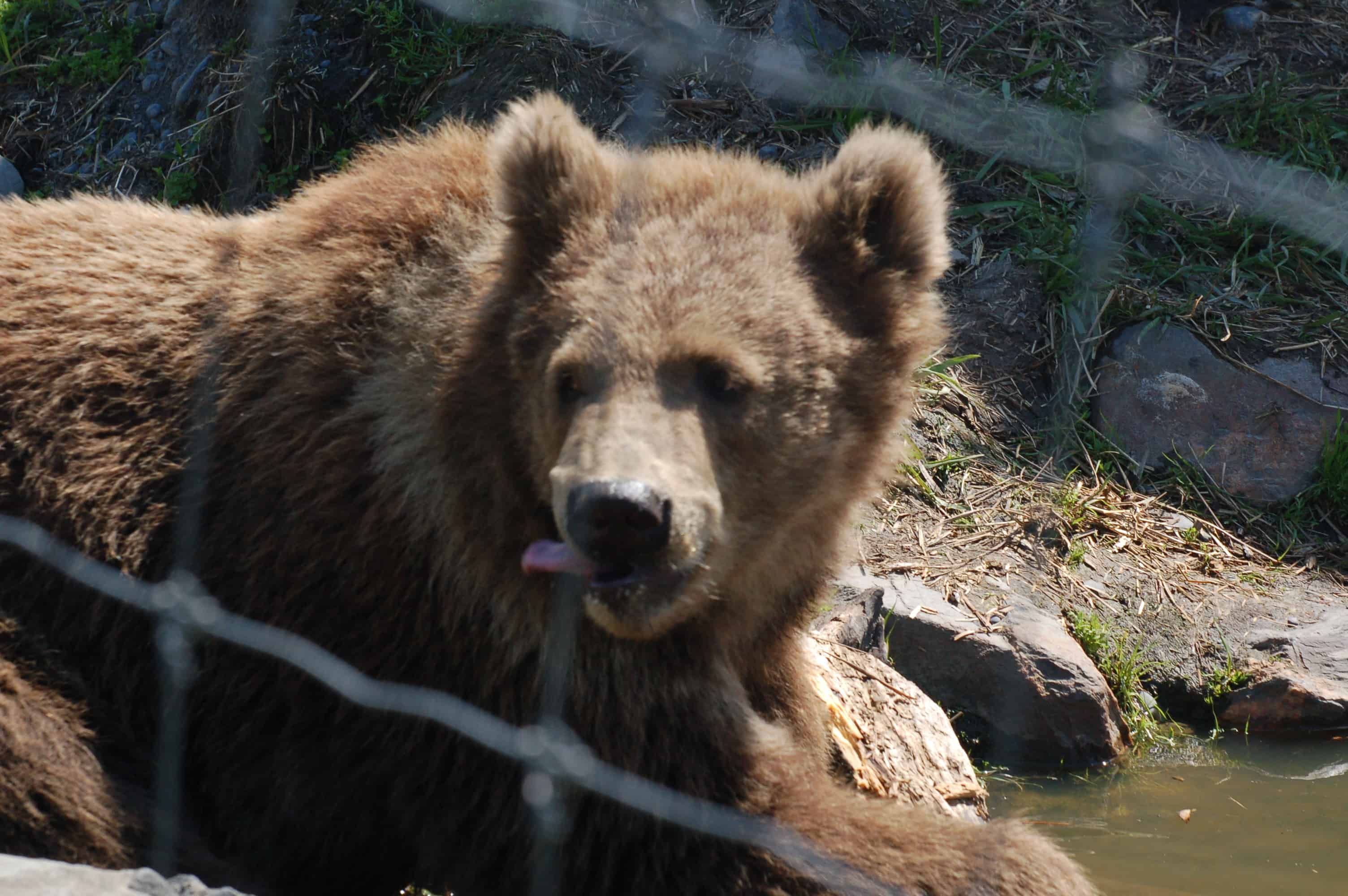
The interesting thing about the Kodiak bear is that they actually grow larger than the brown grizzly, even though genetically they have the same DNA. Kodiaks have been separated from the other browns for over 1,200 years on the island.
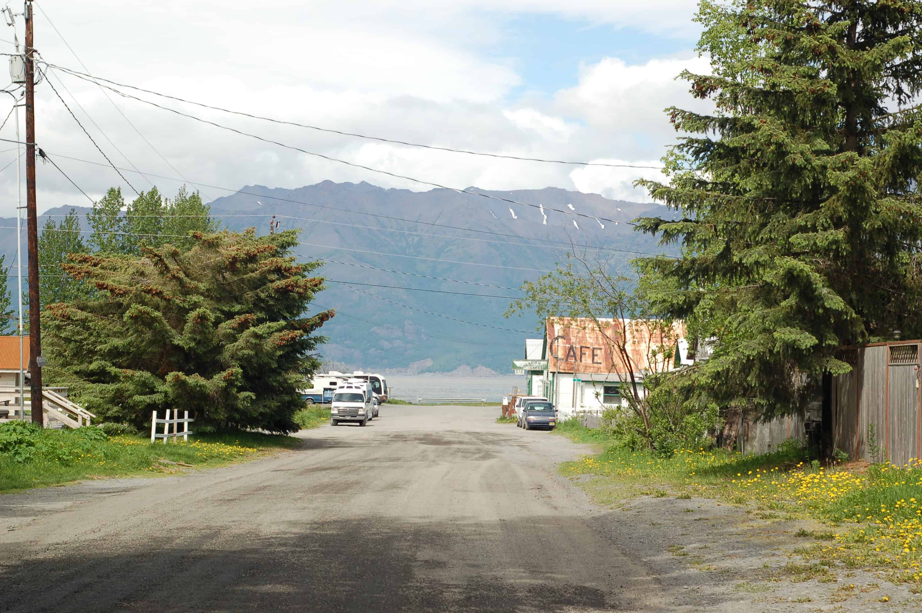
As we drove toward Seward we took the side road to Hope, Alaska.
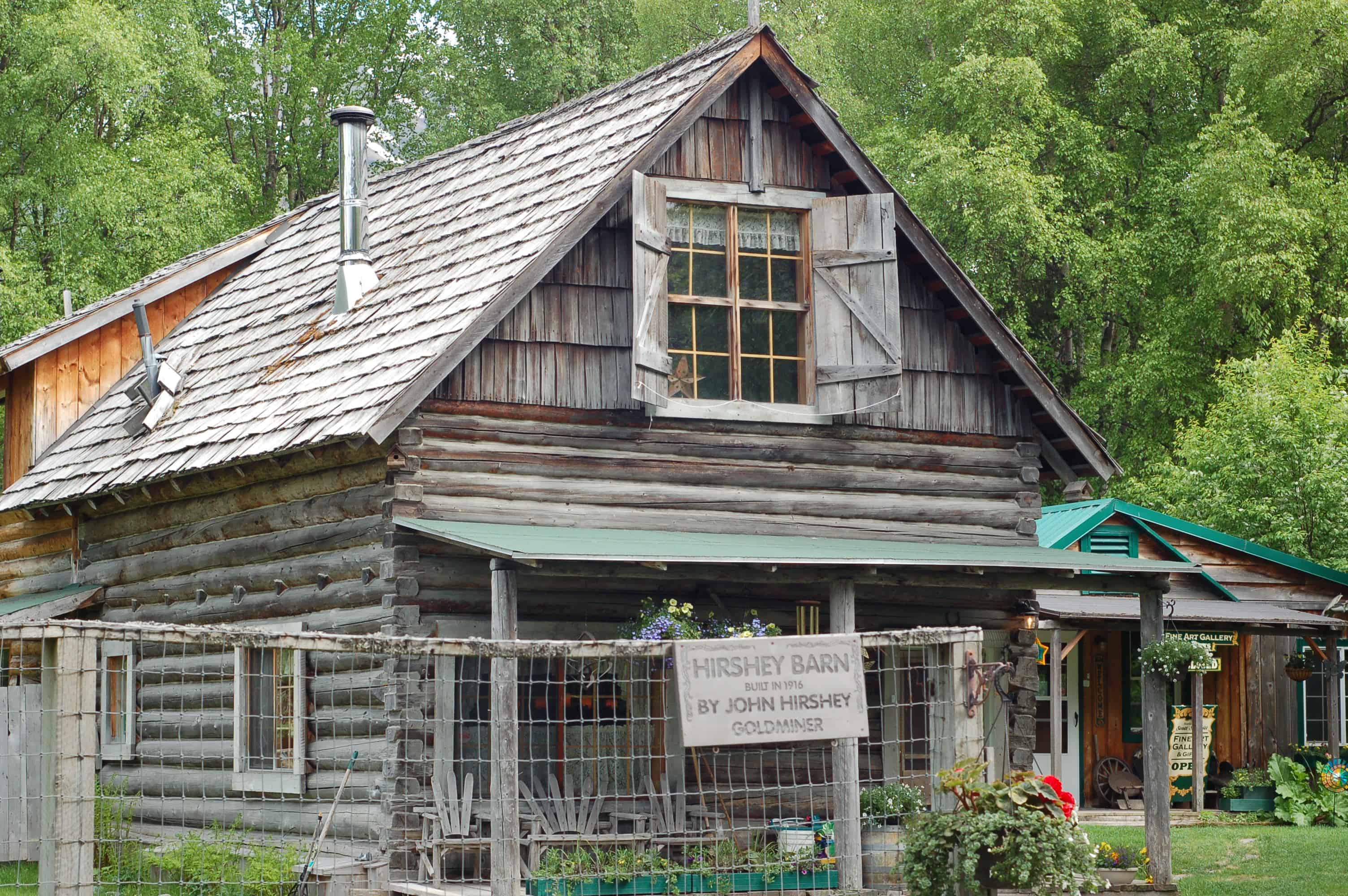
Hope was named for Percy Hope, seventeen years old, the youngest to step off the boat for the gold rush. In 1896 it was the largest town in Alaska, with 5,000 residents. The current population is 150. There was gold in "them there hills," the Turnagain Arm Gold Rush, and fortune seekers came to stake their claims. Hope's population dried up quickly once word reached them about Nome, and most of the prospectors moved on. The town kept mining gold on a smaller scale well into the 1940s. The 1964 earthquake was another blow. The last two blocks of town disappeared into the water.
If you stop in Hope, there is a spot on Resurrection Creek open to the public for gold panning, only 1.5 miles from the original find. Across from the museum there is an ice cream store,
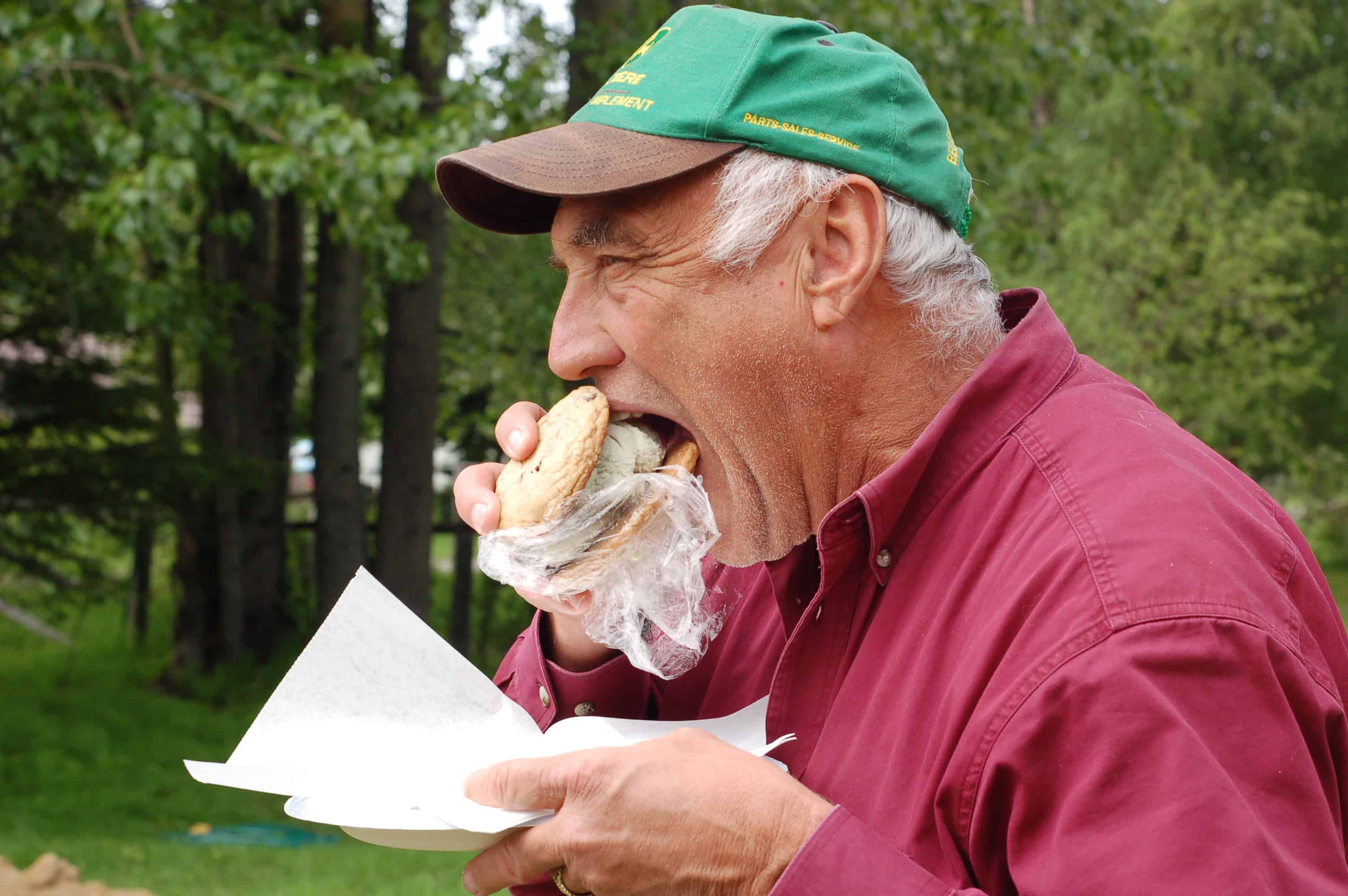
with ice cream sandwiches made from homemade ice cream and homemade chocolate chip cookies.
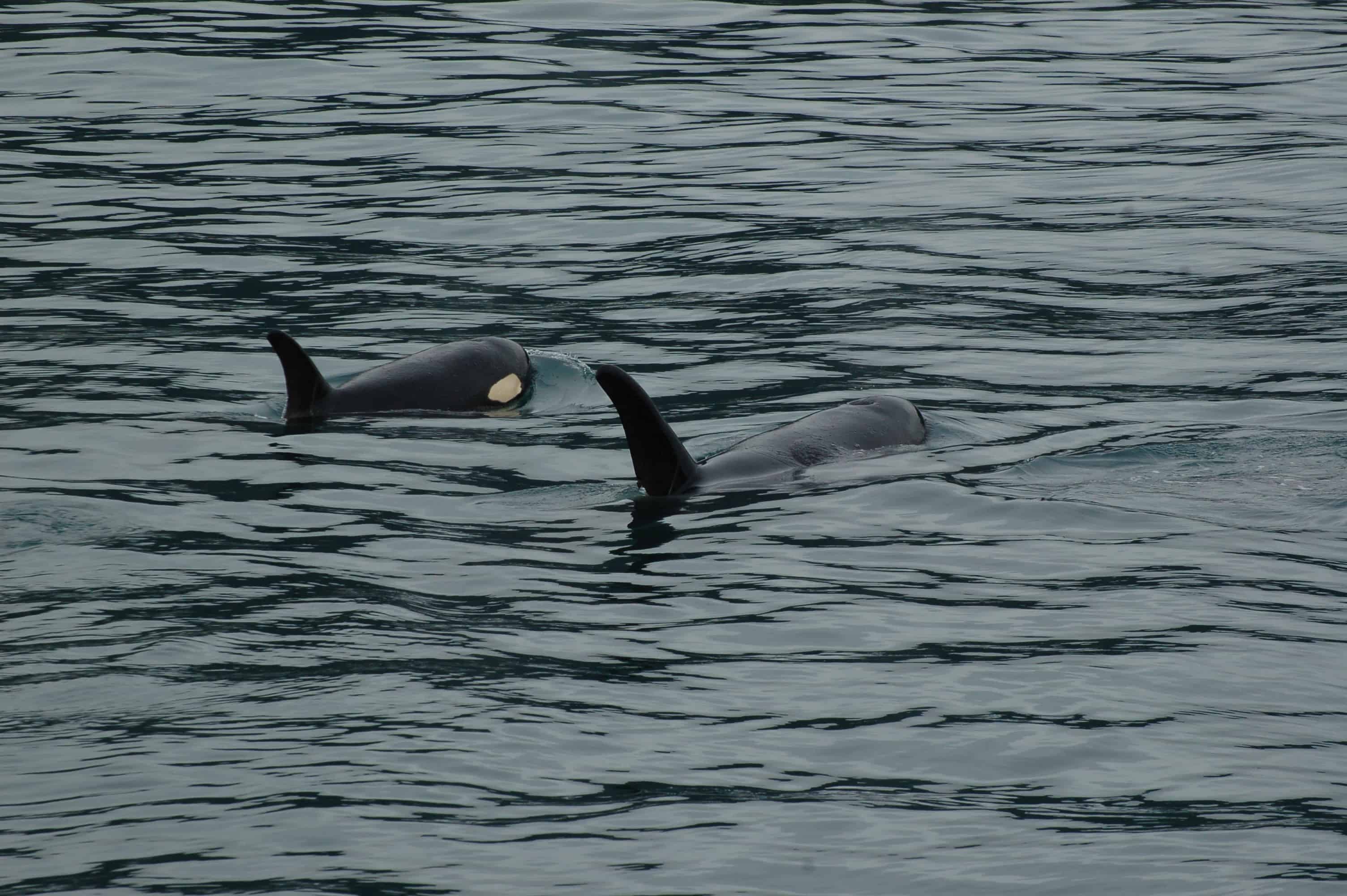
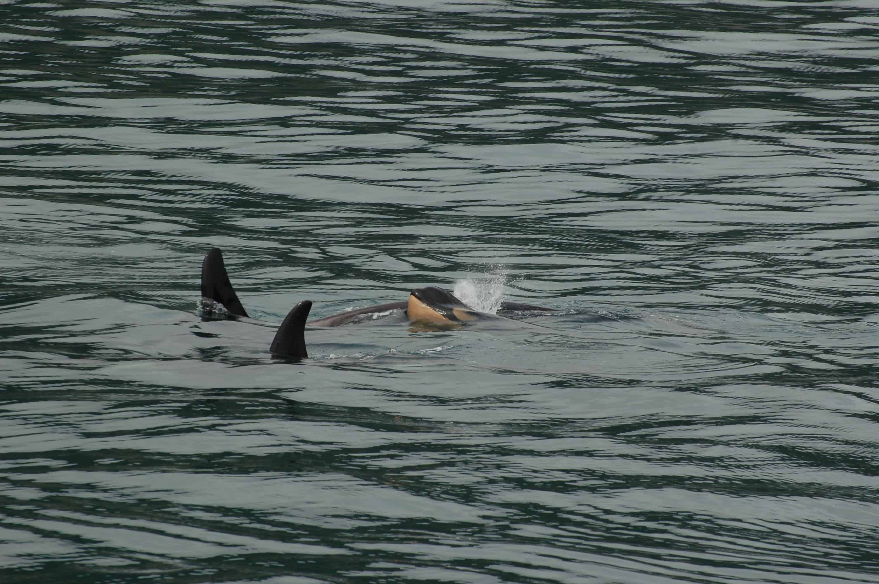
On to Seward. The drive only kept getting more beautiful, and we arrived around 6:30 at the RV site we had reserved, right on the water, sensational views, top rates. There were a few problems. No fresh water. The space was not level. We drove back, asked for a refund, and took off for greener pastures. On the way we stopped for dinner in town and had some fantastic halibut and salmon, then found the new RV park with our friends Hal and Kim already there. A few glasses of wine and we were ready for bed. In the morning we went out on our third glacier cruise. You start to reach a point where, like the churches in Europe, once you have seen one you have seen them all. But on the way out we came across a pod of eleven orca whales.
The mother runs the family. The males may leave for a while,
but they always return. Gestation runs 17 months, and a female on average has three or four babies in a lifetime.
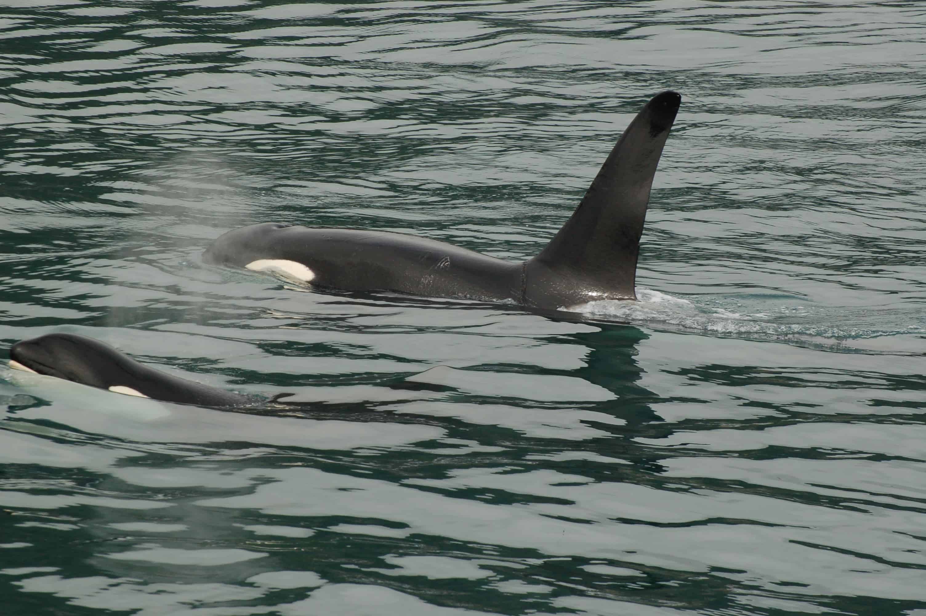
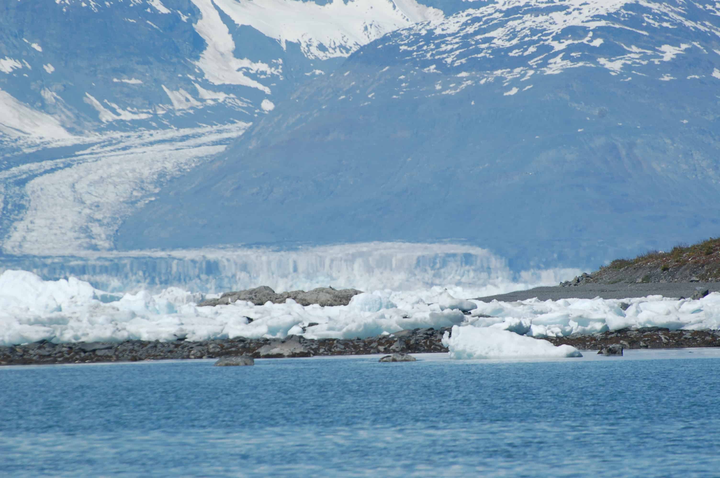
Tom Colbern, from the National Park Service, was our guide, and he told us that seeing this many orcas together was very unusual. What a thrill. We visited Holgate Glacier as well,
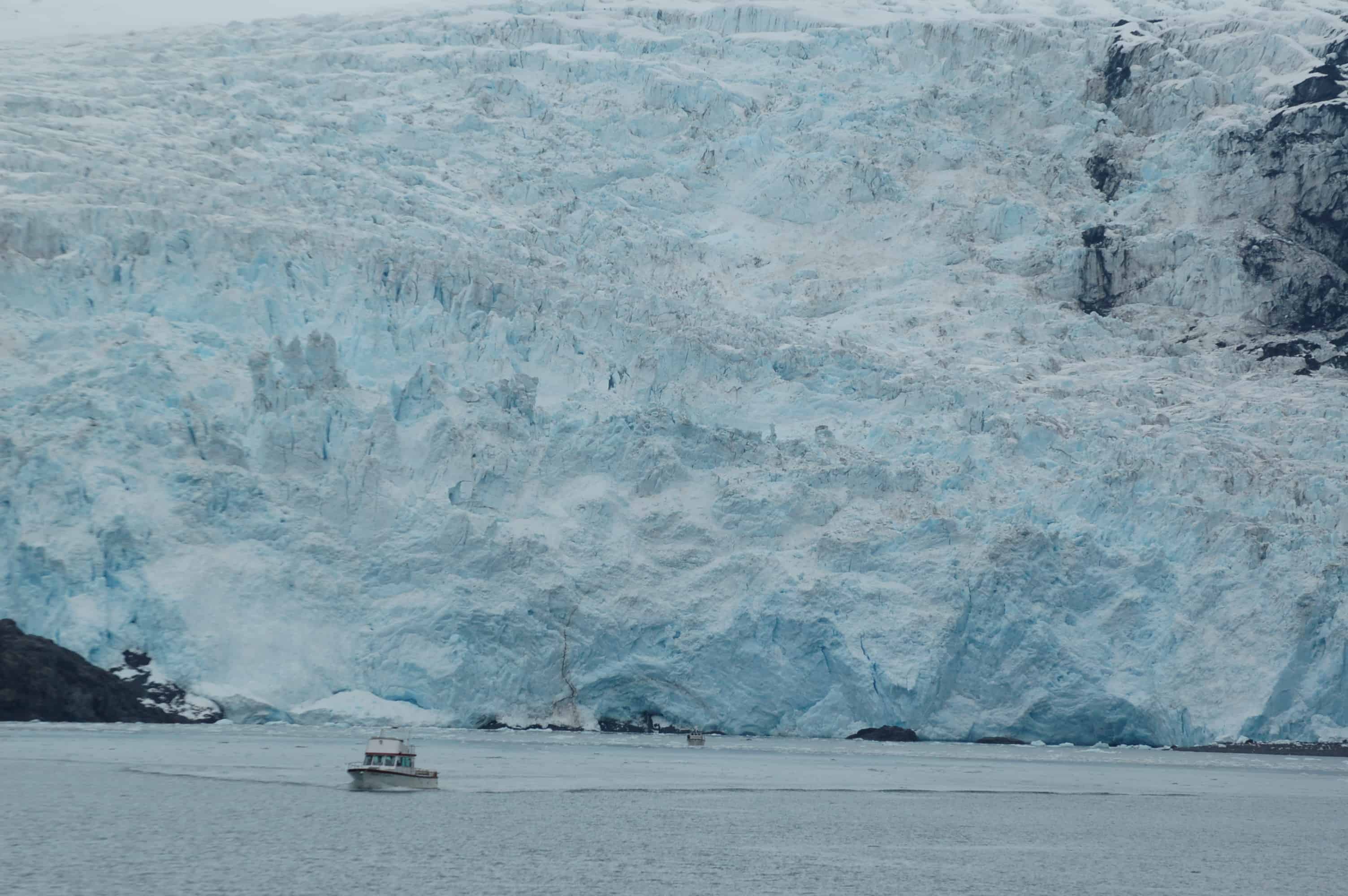
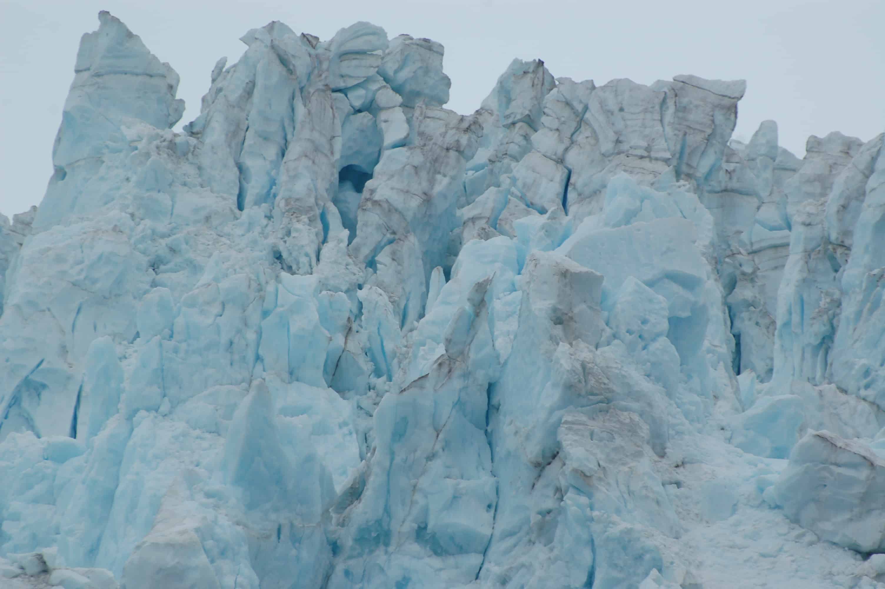
which was sensational. What interested us was that there was no ice flow off the face. The entire glacier sits on land, unlike Columbia and Sawyer Glaciers, which are tidal and shed their ice straight into the water as icebergs.
We headed back into Seward for the night, planning to push on to Homer in the morning.
On the way to Homer we stopped at Cooper Landing on the upper Kenai River and checked in with the local National Park ranger about the fishing. Out on the river, people were lined up on the opposite bank, literally ten to fifteen feet apart as far down the river as we could see. Every one of them was in hip boots well above the waist. We thought somebody was going to go over with the speed of the water. They were all fishing for sockeye salmon swimming up the river to spawn.
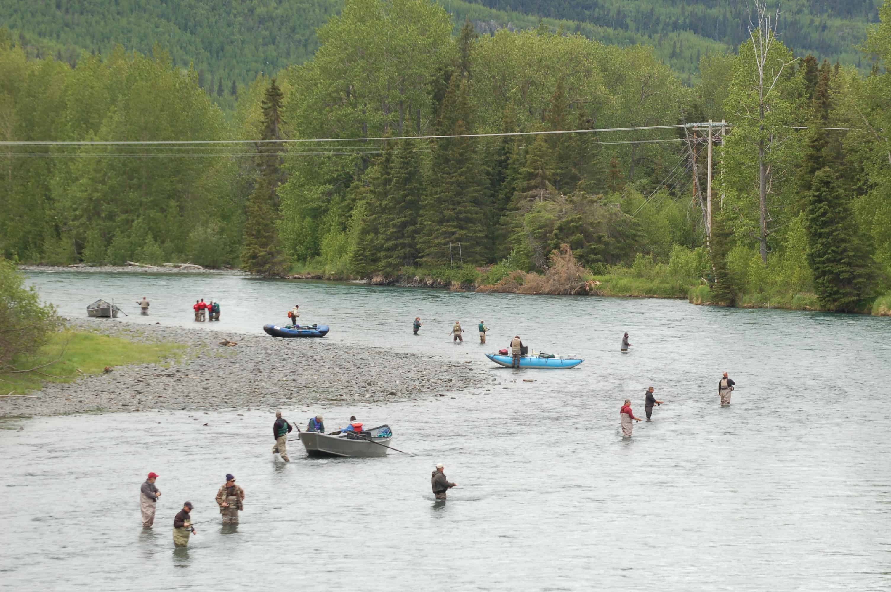
The ranger explained that at this point in their life cycle, the sockeye do not eat. Catching one is a matter of luck, when the fish has its mouth open and the hook catches in the mouth. Snagging a salmon on any other part of the body is illegal. Most salmon run on a four-year cycle from the moment they hatch. They make their way out of the spawning area, down the river to the ocean, survive there for the years they need to, and return to lay their eggs. Once the eggs are laid the fish die and become food for the new generation. The window for good eating is early in the spawning run, since the closer the fish are to the spawning grounds, the closer they are to dying, and they begin to lose the firmness you find in commercially caught fish. Commercial fishermen catch the salmon out in open waters, not on their way up the river. The ranger told us that later in the season the fish are so thick in the river it would be hard not to snag one. King and Silver salmon make their runs later, and they give a real fight on the line. Michener tells the story of the salmon in his book "Alaska," and it gives you a strong sense of what that life cycle is all about.
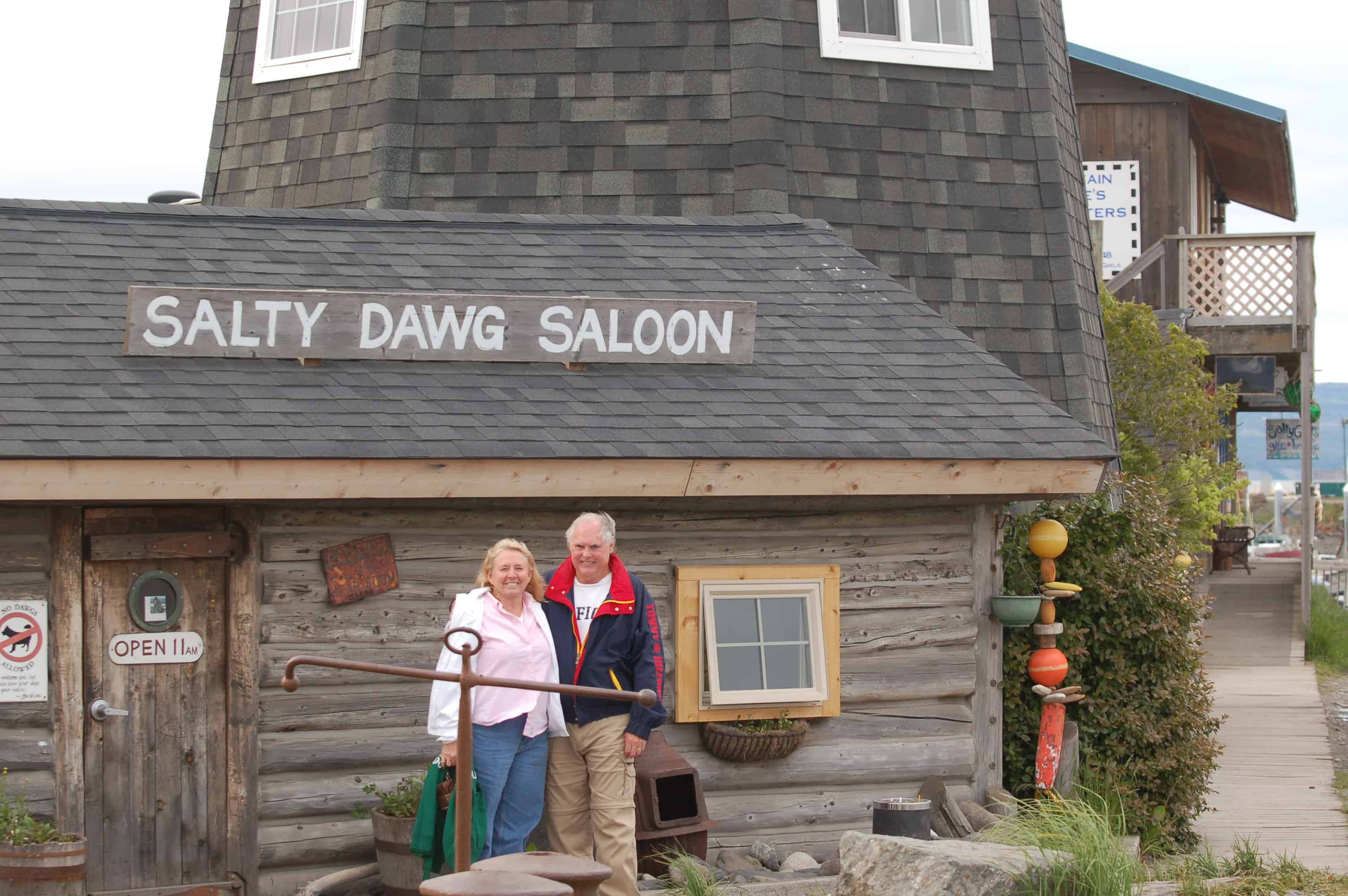
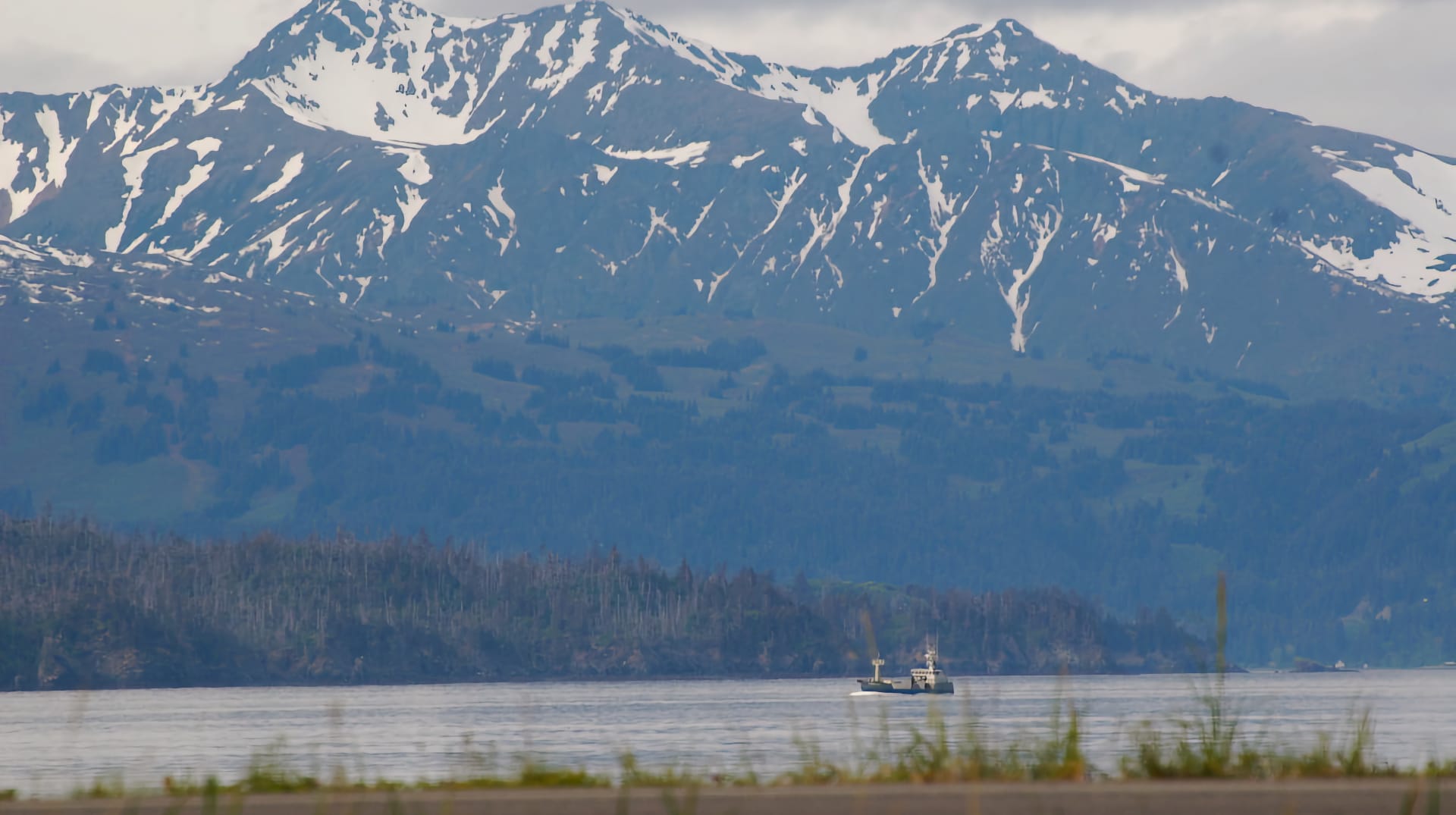
We rolled on toward Homer, and the views just kept opening up. Looking west, we could see mountains across Cook Inlet and out toward the Aleutian Islands, part of the Aleutian Range that is an extension of the Alaska Range. As we came over the crest above Homer, the view down to the Homer Spit
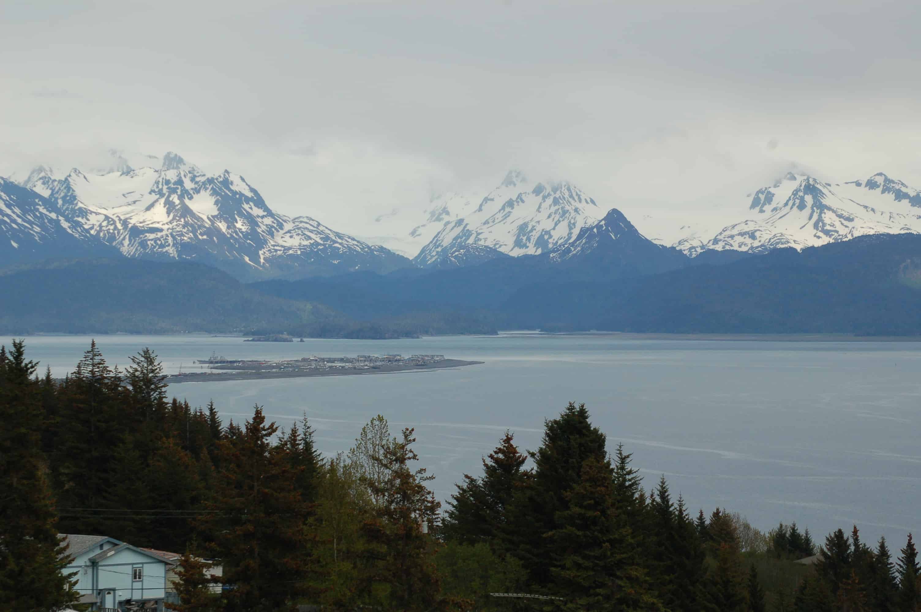
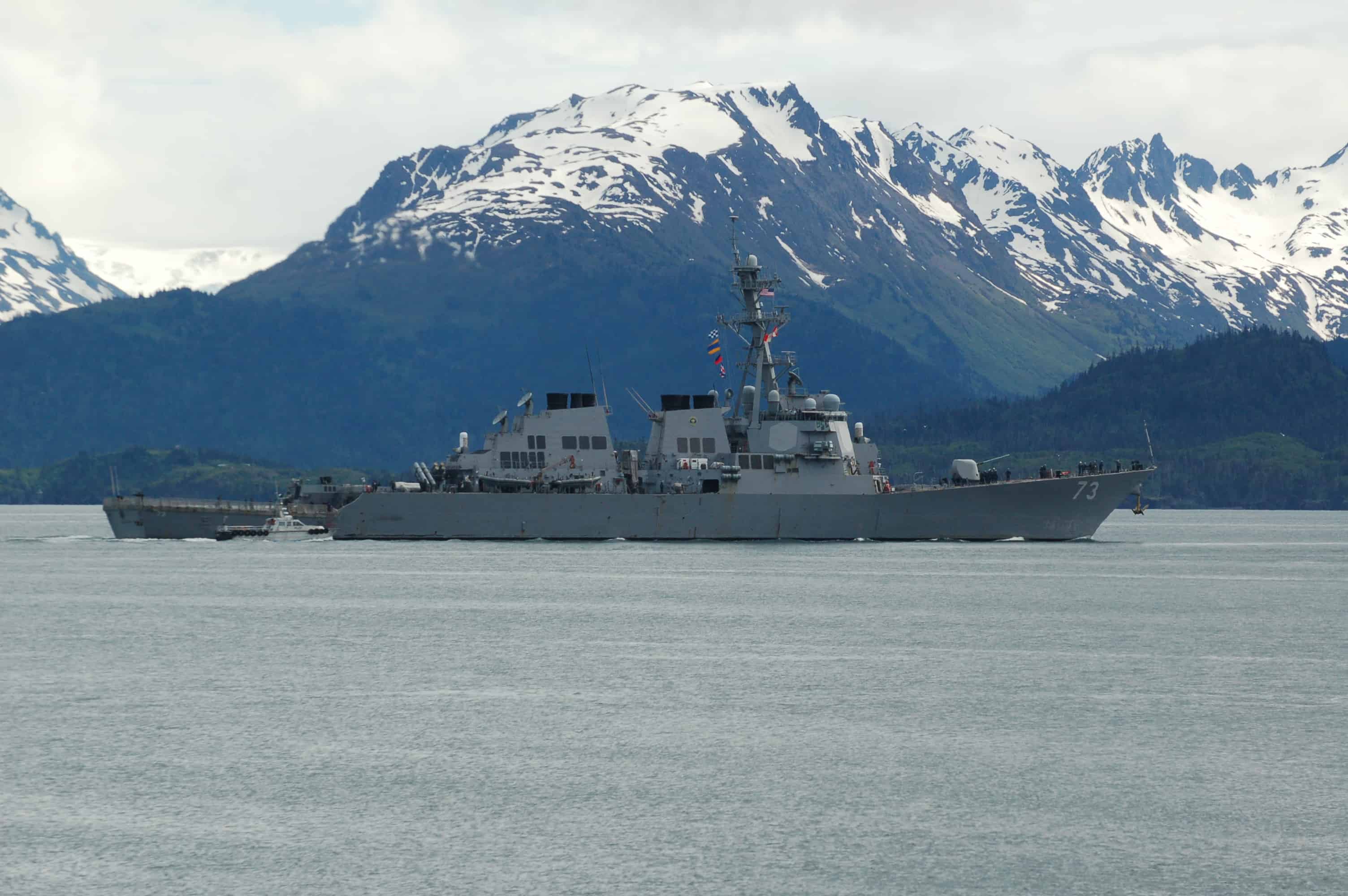
with the mountains behind it was stupendous. We dropped into town and looked around before heading out onto the spit. We stopped at the "must visit" Salty Dawg saloon. We fell into conversation with some young Navy sailors in port on their destroyer, thanked them for their service, and bought them a few beers. It was a great pleasure to spend time with these fine young people. We tend to be partisan about our service people because of James in the Air Force and Chris Wilson in the Coast Guard. After that, it was on to the city RV park to enjoy our BBQ chicken from the store, since we cannot cook every night. We woke to a beautiful sunny morning. This was the view out the window looking west.
We spent the morning walking the spit. The weather hovered around 60 degrees and sunny, just about perfect, almost sweater weather for us and bikini weather for the Alaskans. We finished the walk around one o'clock and ran into our friends Ann and Ruth, who suggested lunch at a place called Lands End. We went there and had a great meal. While we were eating, we saw the young men and women we had met at the Salty Dawg shipping out on the destroyer leaving Homer.
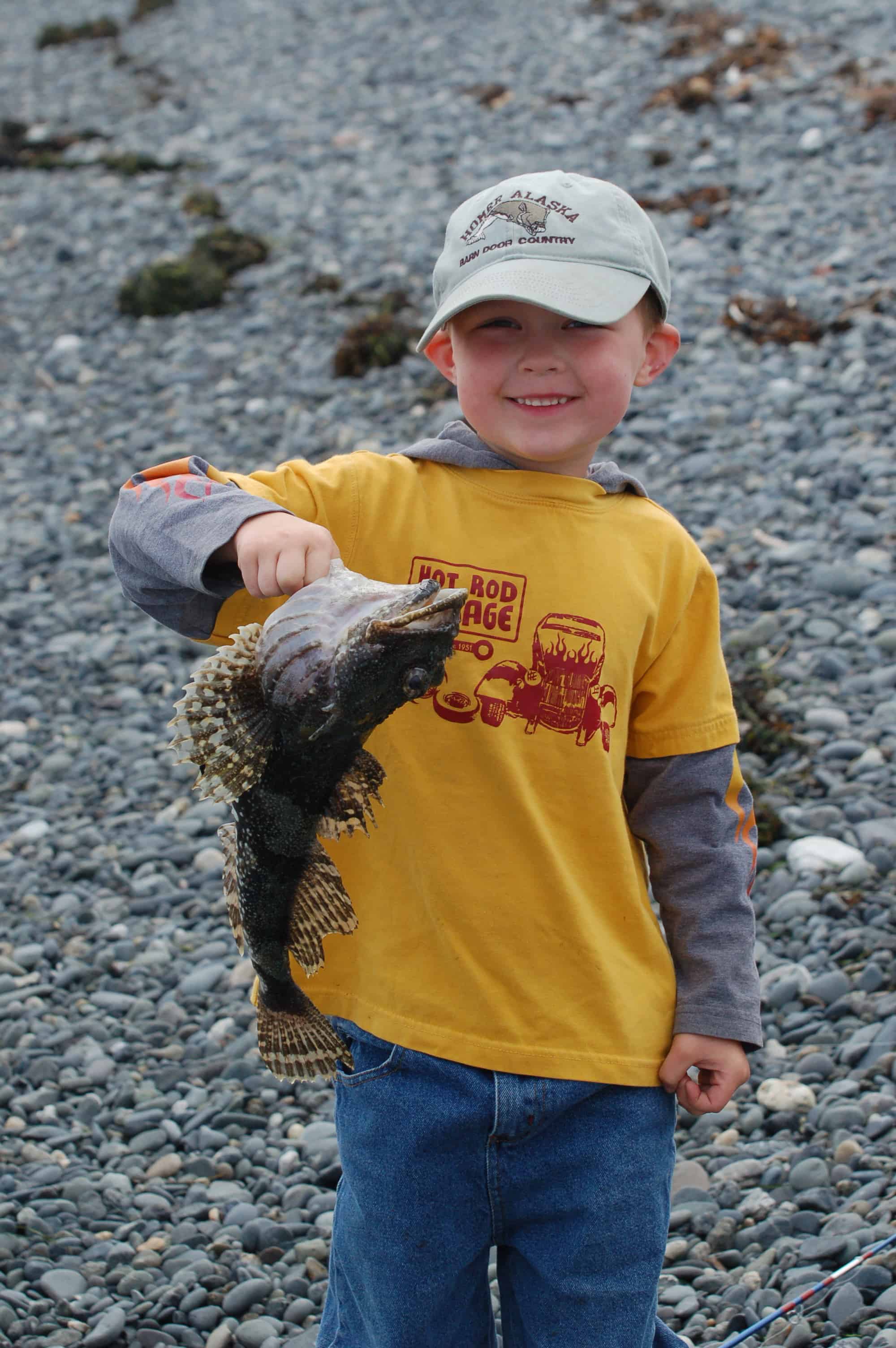
We also watched people fishing off the beach. The men were pulling up some large cod, and we saw one four-year-old boy catch his very first fish. We ran out with the camera and got a picture of him smiling, holding the fish up, what a wonderful day.