Dateline July 17, 2012, Trinity and Gros Morne National Park
We left St. John's in the morning and started west on the Trans-Canada Highway. The road takes you across the base of Trinity Bay and then up its west side, with regular turn-offs that lead down to the water. The first town we visited was Brigus, the birthplace of Captain Robert A. Bartlett, the Arctic mariner who is immortalized here.
"It's all right while you're exploring. You get used to rotten meat, frozen fingers, lice, and dirt. The hard times come when you get back." — Bob Bartlett (Log 13)
Over more than fifty years at sea, Captain Bob Bartlett skippered some of the most famous, most dangerous, and most controversial expeditions to the Arctic. He traveled farther north than almost any other living person of his time. He was shipwrecked at least a dozen times. He survived for months in the barren Arctic after the sea ice crushed his ship, and he traveled hundreds of miles by dogsled to reach civilization. Despite all of it, Bartlett went back to the Arctic whenever circumstances allowed, and almost always brought back photographs, film, and scientific data that meaningfully advanced what the rest of the world understood about the north.
There were signs leading us to "The Tunnel," and Janice worried we would get there and the RV would not fit. As it turned out, the tunnel was not part of the road we were driving.
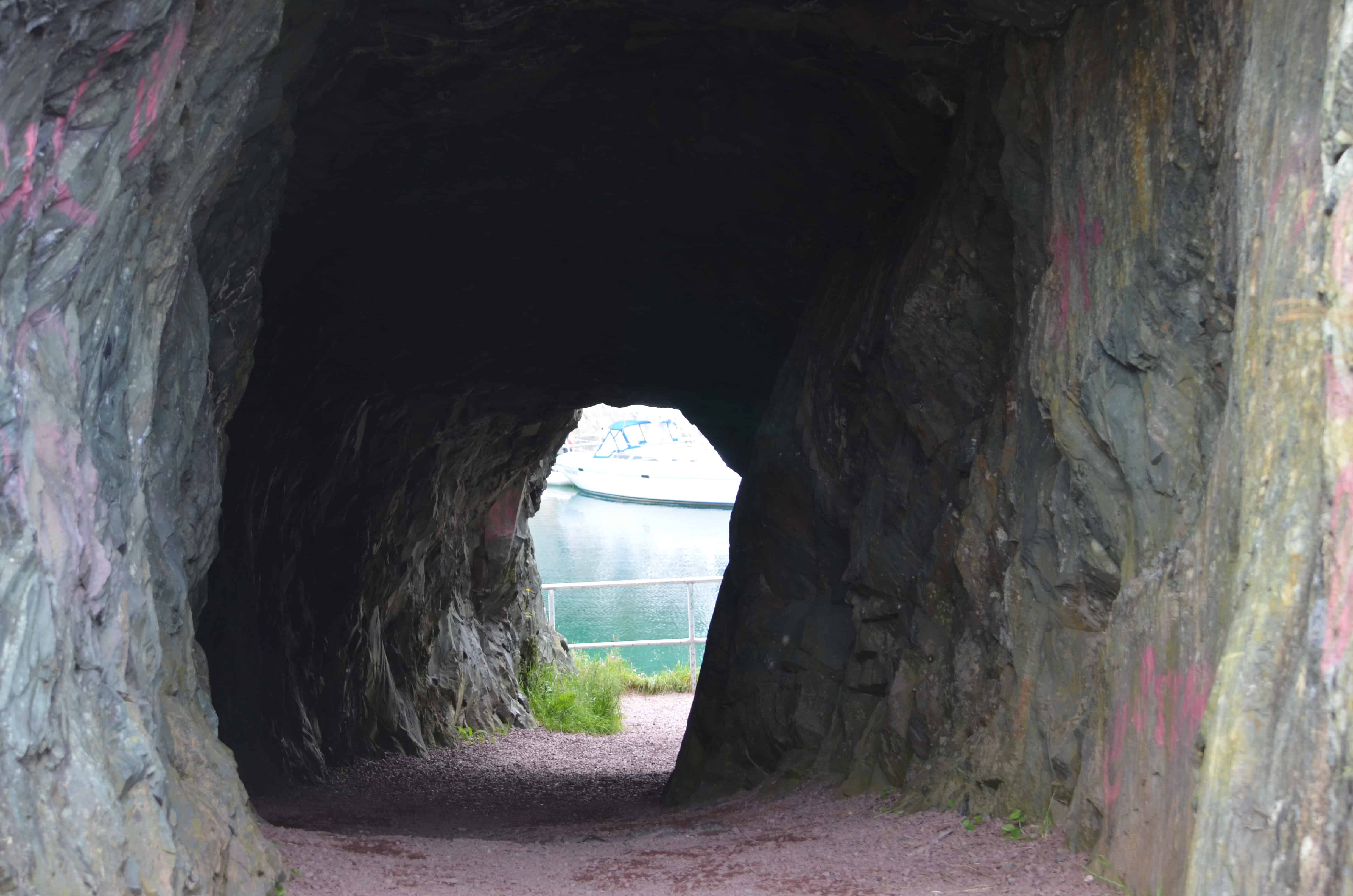
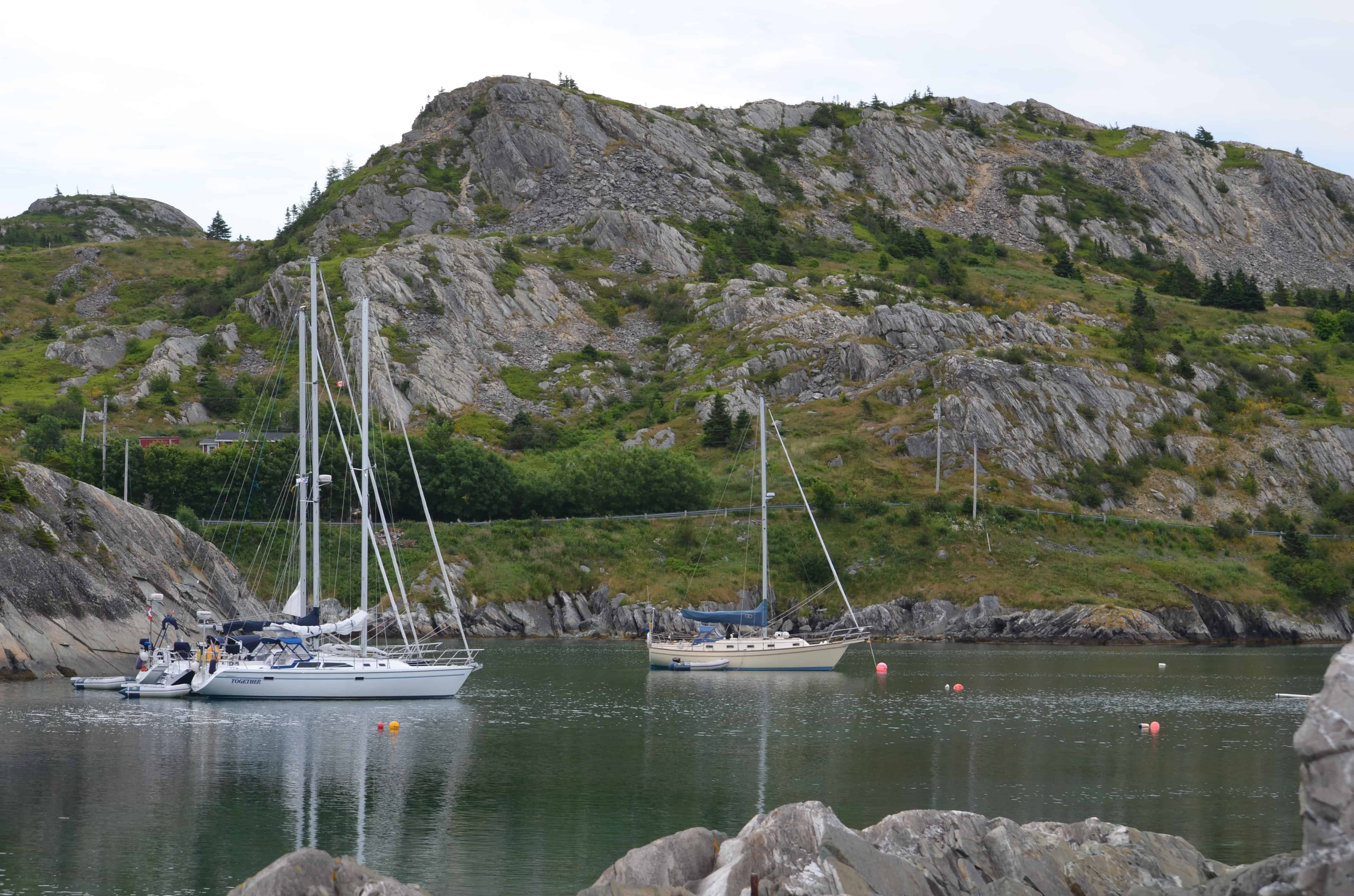
The Tunnel is cut through solid rock on the Brigus waterfront. It was built in 1860 under the supervision of John Hoskins, a Cornish miner. It took four months to hand-cut and blast the tunnel through, opening up a deep-water berth for Bartlett's sailing ships. Today the harbor is a sheltered overnight anchorage for sailboats.
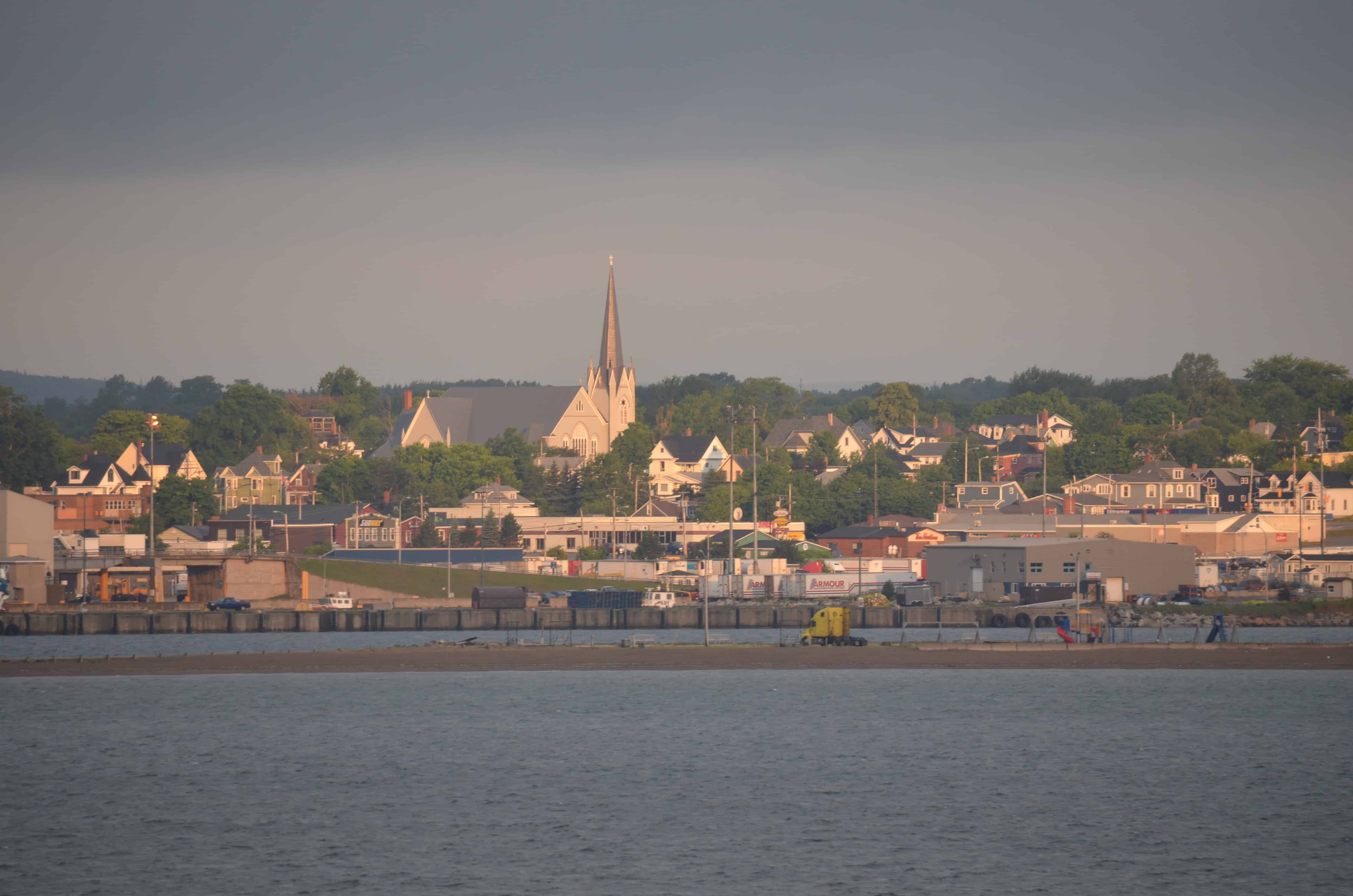
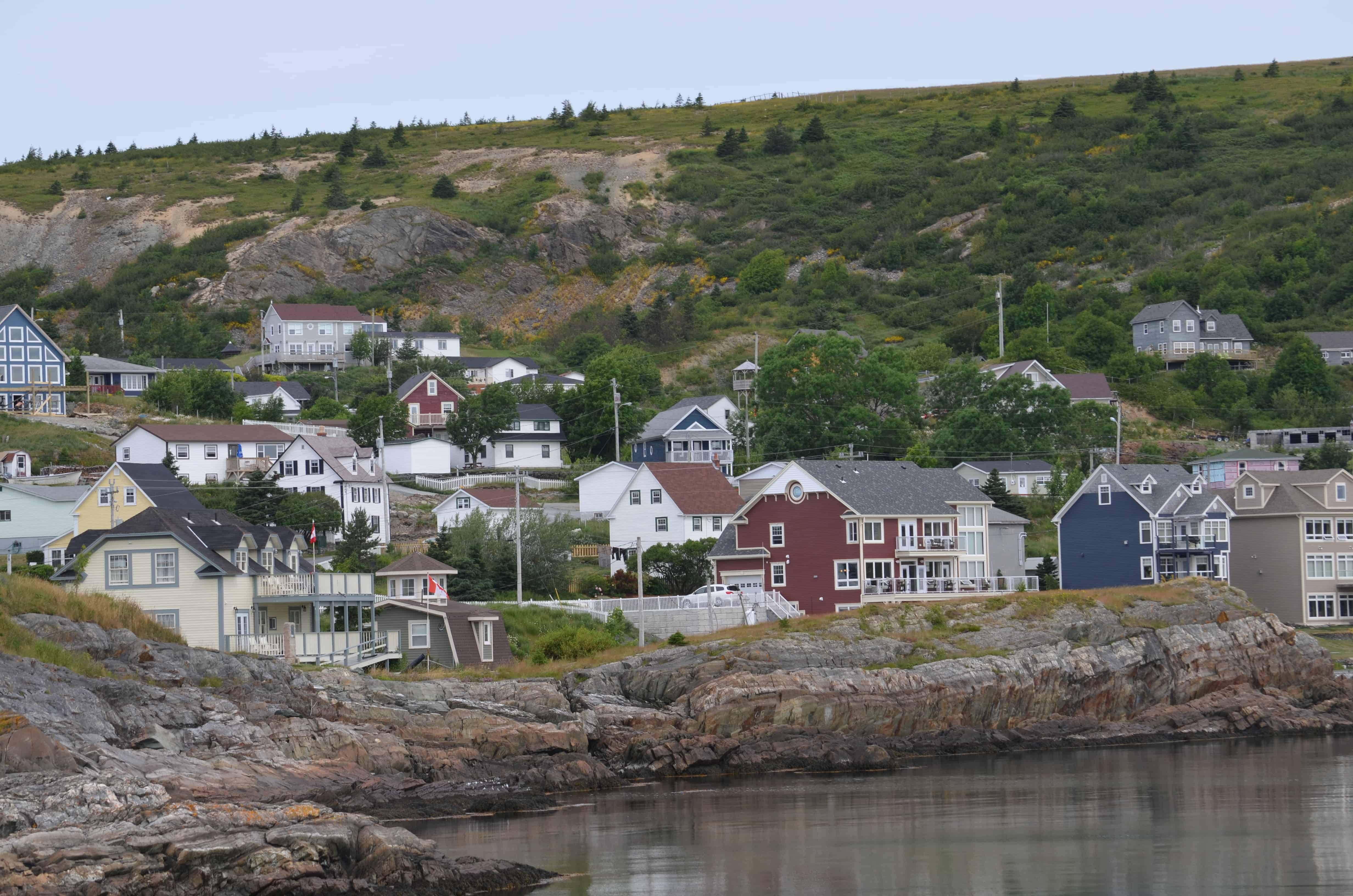
We continued on to Trinity, which has been a viable North Atlantic community for hundreds of years. Its defensible harbor, with plenty of room for ships and shoreline suited to outbuildings, wharves, and fish flakes, made it ideal for the early migratory fishery. Later, merchants from Poole, England, made Trinity the base of a New World fishery operation. In the 1720s, Trinity was home to about thirty permanent families plus 200 to 300 seasonal fishermen. By 1869 the population had peaked at over 800. Until recently the coastal, Grand Banks, and Labrador fisheries sustained the town. The buildings are remarkably well preserved, and Trinity functions today as much as a working residential village as it does a heritage site. New businesses, including theater, have grown alongside the old ones, and the local Trinitarians host thousands of visitors a year.
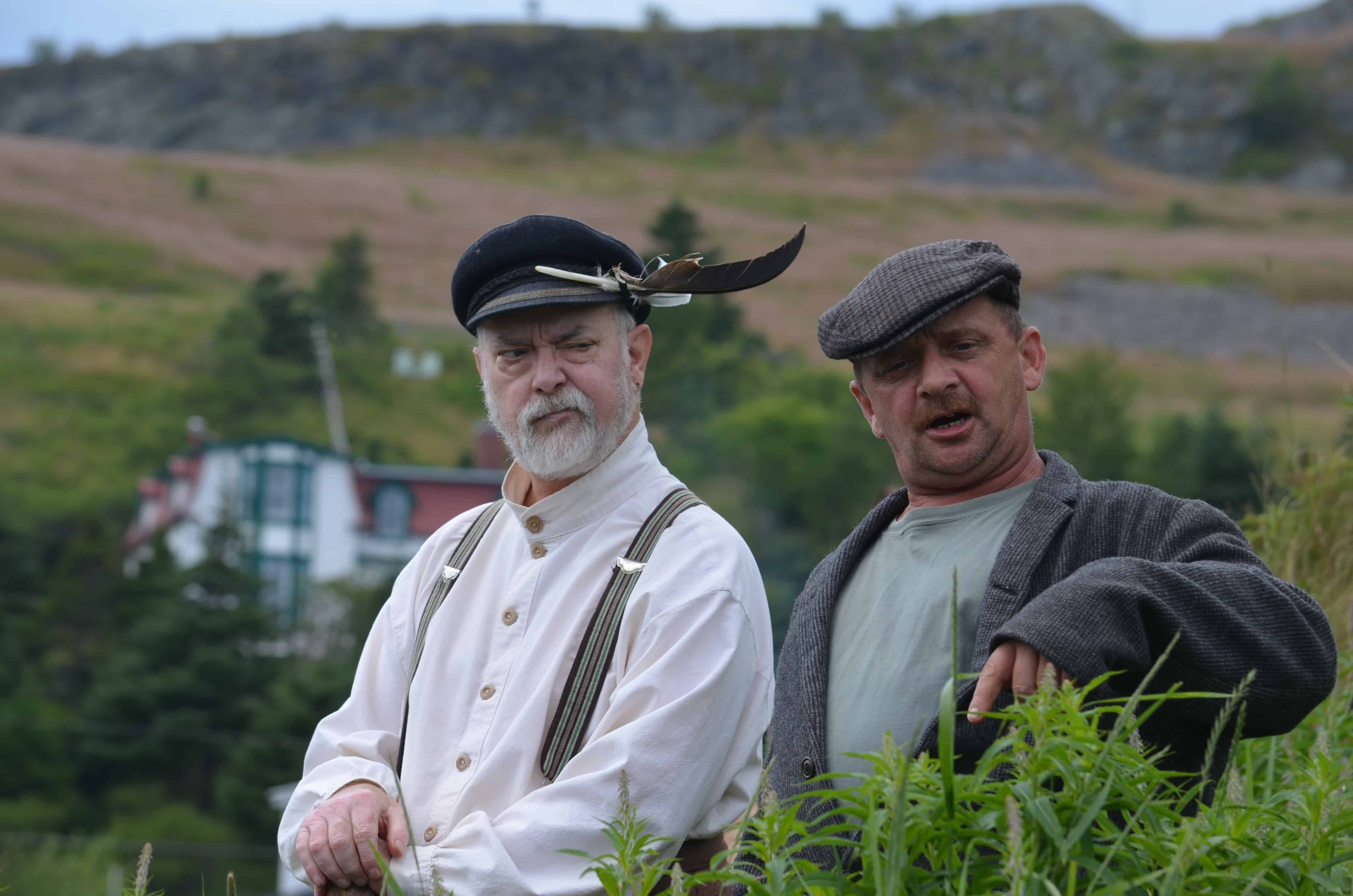
We arrived in time for the Rising Tide Theatre's New Founde Lande Trinity Pageant. The play is a walking tour. The cast leads the audience through the lanes, roads, and historic sites of Trinity, with the story of Newfoundland's settlers unfolding scene by scene, mixing humor and sadness from the early settlers through the 1830s and 40s, in story and song.
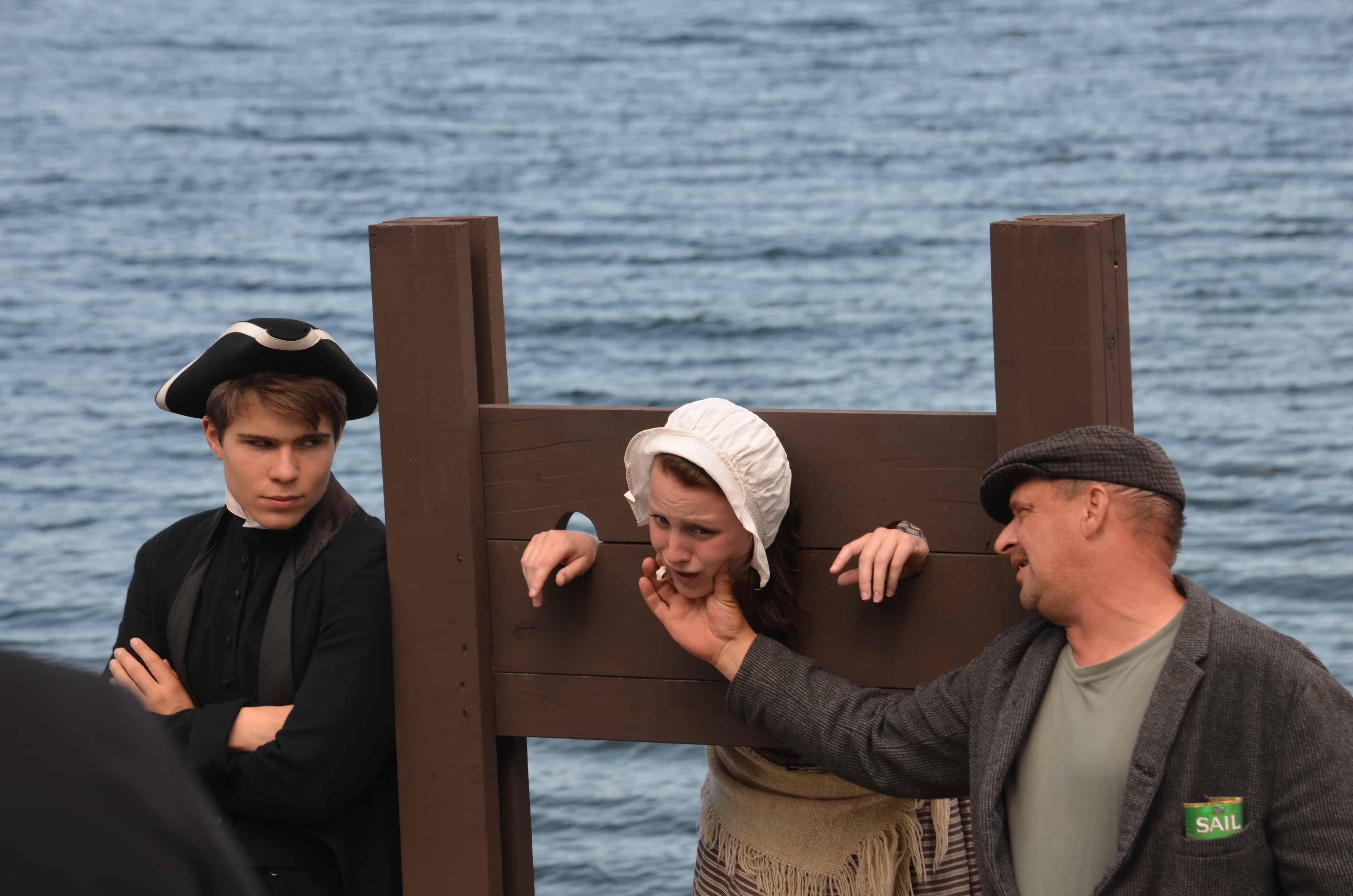
The pageant captures the resourcefulness of the people, the hardships, the deaths, and being "owned by the company store" when the catch was not enough to pay back what had been advanced on credit through the winter. It is very well done, and one of the highlights of our entire trip. If you ever come to Newfoundland, plan a Wednesday or Saturday in Trinity at 2:00 PM and see it.
We spent the night at Terra Nova National Park, which was beautiful. We wished we had planned a few days there. In the morning there was an unusual amount of oncoming traffic going east, back to St. John's. Then we remembered there had been a major outdoor concert in the Grand Falls-Windsor area the night before, and the kids on the way home stopped at the same McDonald's we did, all of them wearing Aerosmith t-shirts. Steven Tyler was the draw. It is interesting to see what American Idol and The Celebrity Apprentice can do for an established entertainer's late-career visibility.
In Grand Falls-Windsor we stopped at the Salmonid Interpretation Center, where Atlantic salmon climb the fish ladders on their way to their spawning grounds.
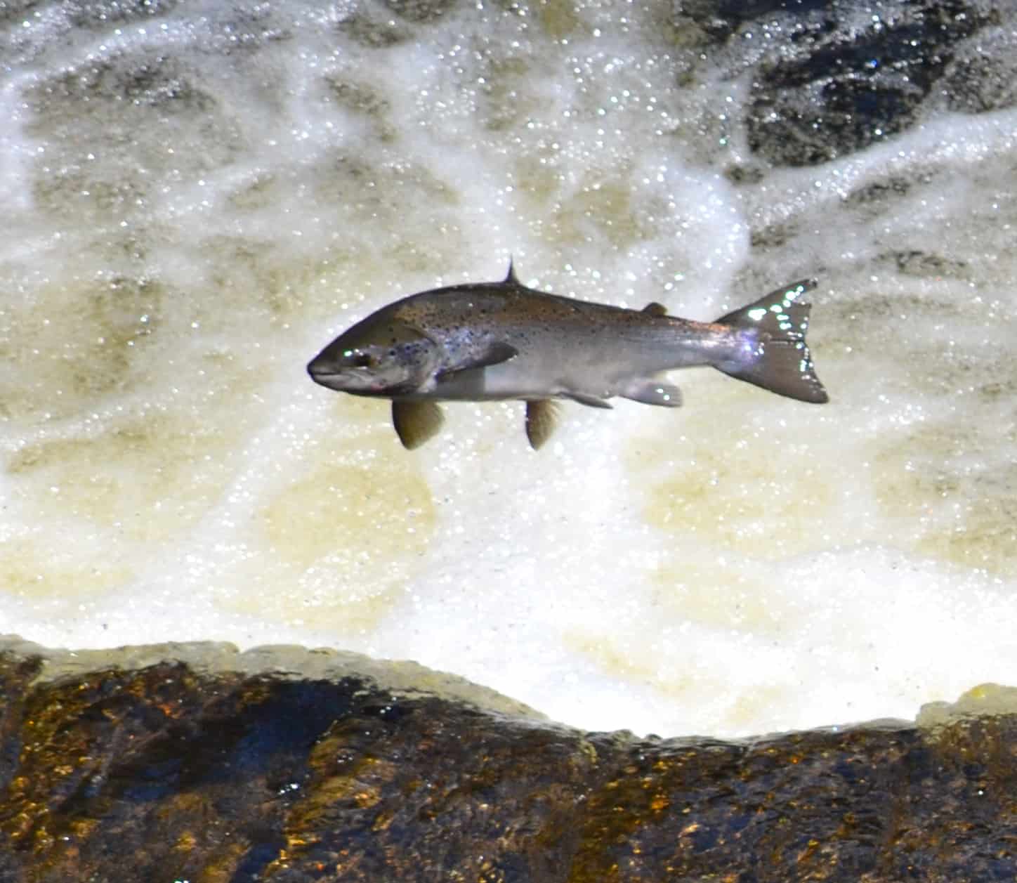
A year earlier we had visited a similar center in the Yukon. There are some interesting differences between Atlantic and Pacific salmon. Pacific salmon spawn once and die. Atlantic salmon can spawn several times. Atlantic salmon stocks have been so depleted that there is essentially no commercial fishery left for them, and an individual angler in Newfoundland may keep no more than six fish a year. We had been wondering why the fresh salmon in every fish store throughout the trip was farmed. Now we knew.
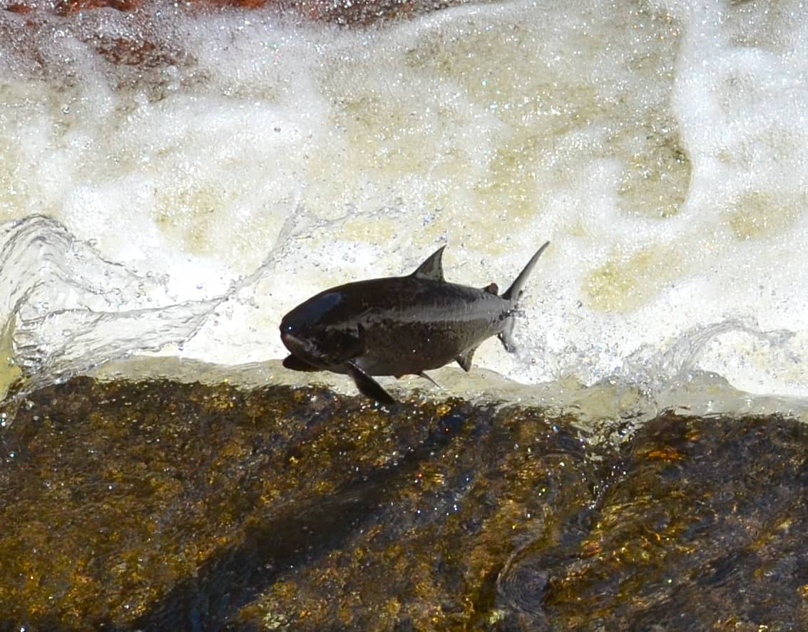
Janice, who has the patience of Job when it comes to nature photography, stood for thirty minutes to catch these few good shots of the fish flying up the ladders.
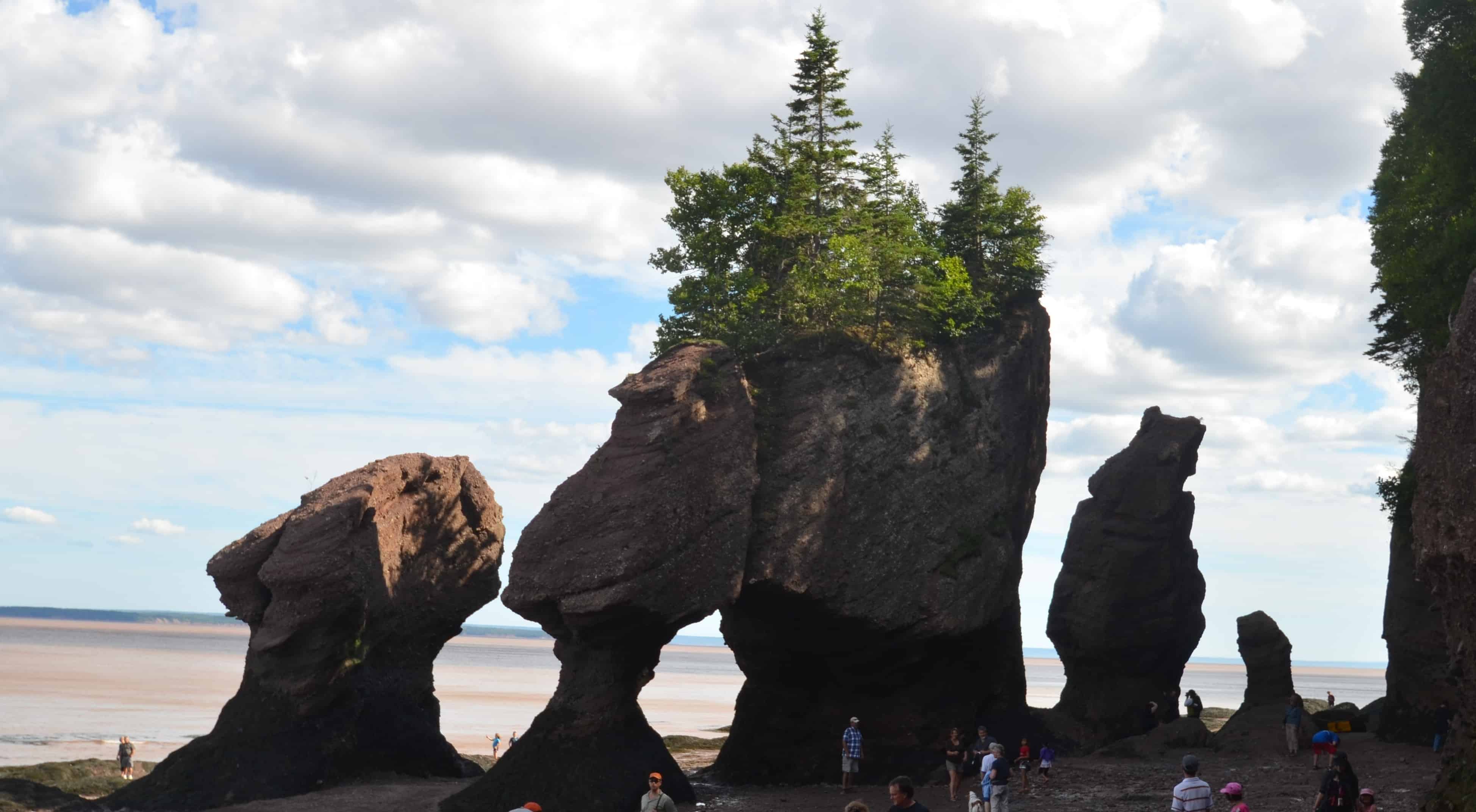
On to Gros Morne National Park. Gros Morne is considered Newfoundland's greatest treasure. Geologists have shown that, 420 to 570 million years ago, the rocks that make up the park were part of an ancient ocean floor that was later thrust up into what became the Appalachian Mountains as two continents collided. The rocks at Gros Morne provided some of the foundational evidence for the theory of plate tectonics. More recently, in geological terms, the glaciers came through and carved the landscape we see today.
The first evening, we were told about a good evening cruise out of Norris Point. We arrived around 6:00 for the 7:00 boat, only to be told there was no Sunday cruise. Two other couples were already in front of us with confirmations. The cruise operator apologized and gave them comp tickets for the Western Brook Pond boat the next day. To our surprise, they gave us comp tickets as well. We then had several beers with Tom, Joanne, Natasha, and Richard, who were down from Ontario, and met them again the following morning in the Western Brook Cruise parking lot, where we all had to walk three kilometers across the bogs and tundra, up and down the hills, to reach the boat dock. The worst part, of course, was the walk back.
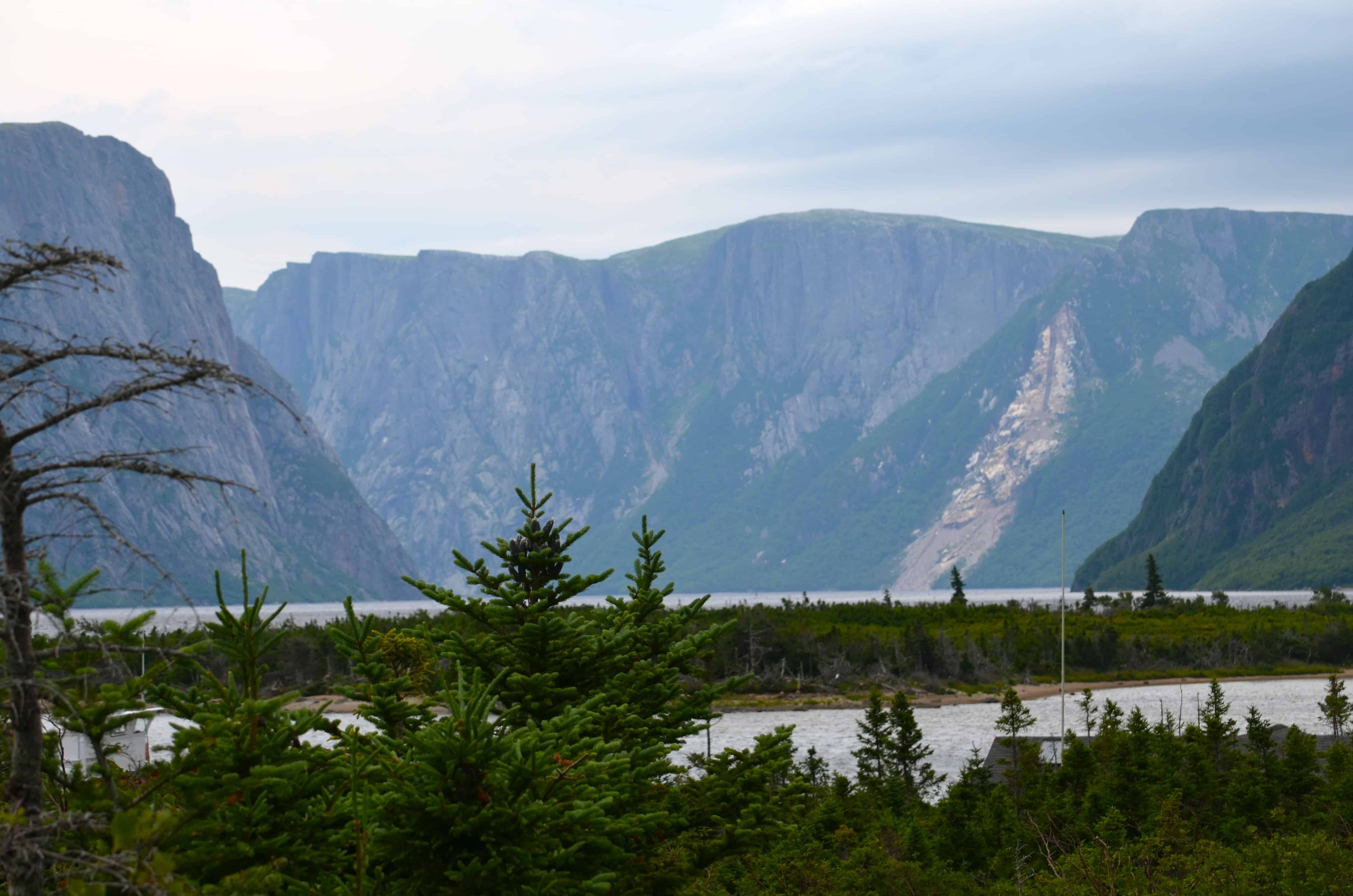
We took the boat down Western Brook Pond, a Canadian freshwater fjord. The story is that glaciers carved out the massive granite cliffs and the gneiss in the walls on their slow path to the sea. Then the land rebounded after the ice melted, and the fjord was cut off from the ocean. Eventually the saltwater flushed out, and what remains is fresh.
The water feeding Western Brook Pond is filtered by the surrounding rocks, leaving it an oligotrophic lake (two-bit word, meaning nutrient-poor). The lake is so low in nutrients that it cannot support fish or much vegetation. The area between the lake and the sea is rock with thin soil, and over the centuries that thin soil has grown bogs more than a hundred yards thick, sitting on top of ridges high enough to keep seawater out. In one section of the bog, the plants are so starved of nutrients that they have reversed the natural order of things and feed off the insects that would normally have eaten them. They are pitcher plants, Newfoundland's provincial flower.
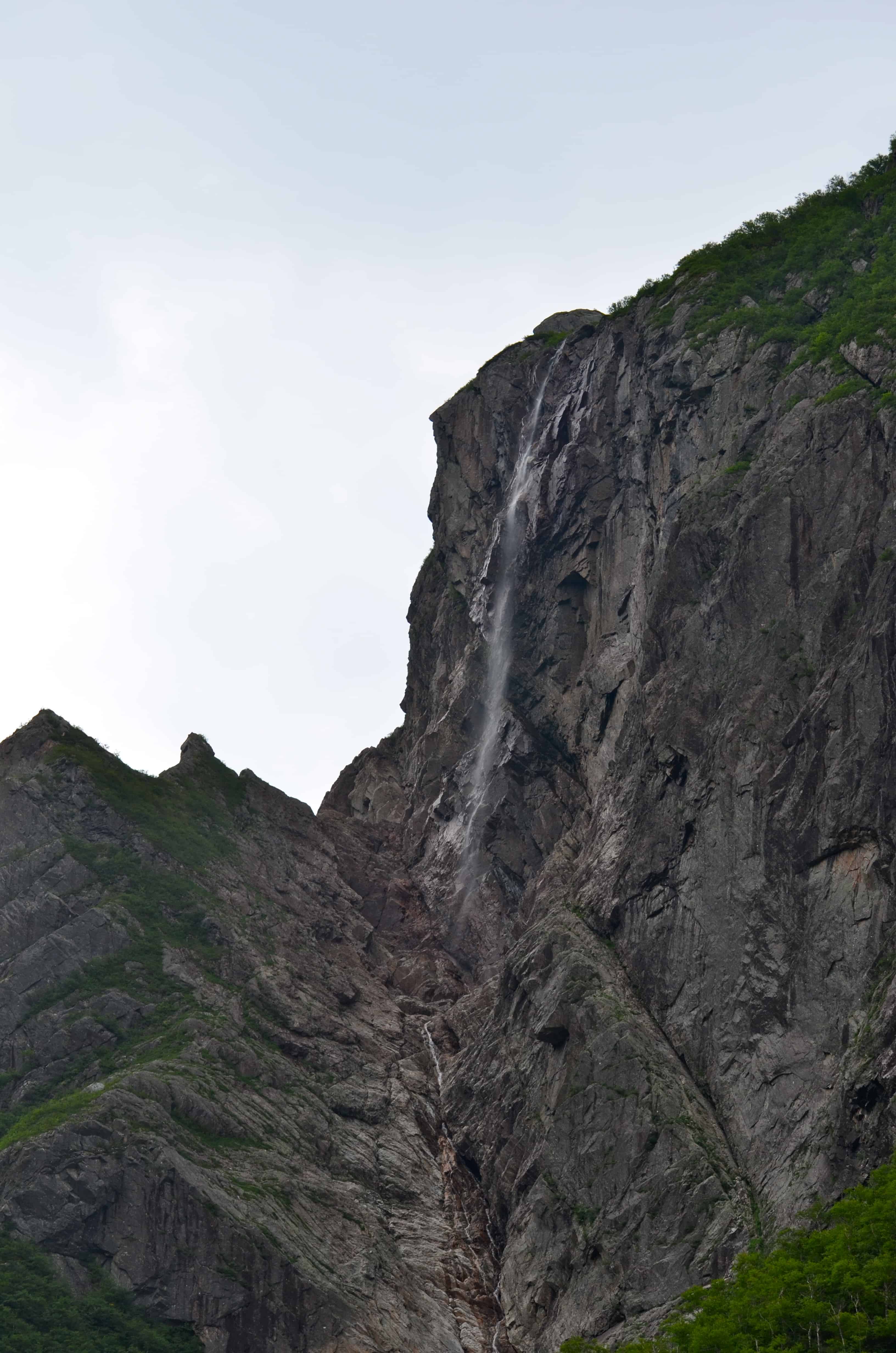
Stag Brook feeds the lake at its extreme eastern end, and a number of waterfalls cascade down from the plateau above. One of them is Pissing Mare Falls, described to us as one of the highest waterfalls in eastern North America. The day we were there, it had not rained recently and the falls were running very low.
The cruise was interesting, and we arrived back at the main dock in a light rain. The walk back across the bogs turned into a full storm. We were grateful for dry clothes in the RV.
We drove around the park and saw a number of other sights, plus several of the local towns. With rain forecast for the next day, we changed our reservation and caught the ferry back to Nova Scotia that night. On the way down to the ferry we drove through Corner Brook, and saw a Holland America cruise ship in port. We were puzzled about what the passengers could find to do, and later, when we looked it up online, found that there was indeed not much beyond a few short hikes.
We continued on toward Port aux Basques. For about thirteen kilometers of road approaching the port, there are warning signs about possible high winds. The signs note that gusts have been measured at over 200 kilometers per hour. There are no warning lights to tell you whether the wind is actually blowing today. Luckily for us it was calm.
We arrived for the 1:30 AM ferry at about 7:00 PM, spent the wait in the terminal, and had dinner in the rig. We arrived back at North Sydney, Nova Scotia, around 7:30 the next morning.